- Best months
- April, October and November
- Getting there
- Highway 35, or Highway 25 from Wabasha
- Bring
- Binoculars, a warm hat and patience for a passing tow
Below Lake Pepin the Mississippi stops behaving like a lake and goes back to being a river, split into channels, sloughs and wooded islands. Highway 35 follows it south along the Wisconsin bank, and the first two towns it reaches are Nelson, at the junction with the road to Minnesota, and Alma, stretched along the shore under a wall of bluff a few miles further on. Between them lie wide bottomlands, a working lock and dam, and one of the best overlooks on either bank.
Across the river from Nelson is Wabasha, best known for the bald eagles that gather on the open water below the lake each winter. The two towns are linked by the Wabasha–Nelson bridge, which crosses the main channel and then a long causeway over the bottoms on the Wisconsin side.
Nelson and the bottoms
Nelson is small, a crossroads village at the foot of the bluff where Highway 25 comes in from Wabasha and meets Highway 35. Most people pass through it on their way somewhere else. Stop, though, and look at what lies between the village and the river.
Here the Chippewa River comes in from the northeast and meets the Mississippi. Over thousands of years it has spread a broad delta of sand, marsh and floodplain forest across this stretch of valley, the same delta that dams the river upstream and creates Lake Pepin. Much of the lower Chippewa bottoms is now protected land, including Tiffany Bottoms State Natural Area, where silver maple, cottonwood and swamp white oak stand in water for part of the year.
These bottoms are good country for birds and for quiet. In spring you hear frogs before you see anything; in summer, prothonotary warblers and herons work the sloughs; in autumn the floodplain forest goes yellow. The ground is wet, the mosquitoes are serious in early summer, and the river can rise quickly after heavy rain upstream, so check conditions and dress for mud. Hunting seasons apply on public land here, so wear a bright layer in the autumn.
The causeway on Highway 25 is the easiest way to get a feel for the bottoms without getting your feet wet. It runs low across the floodplain between Nelson and the bridge, with sloughs and backwater lakes on both sides, and in high water the river spreads right up to the embankment. Use designated pull-offs and landings rather than stopping on the roadway.
Alma, one long street
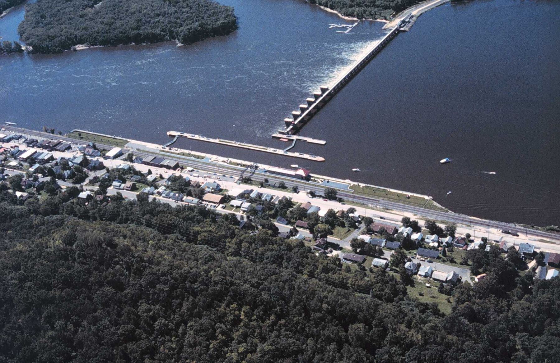
Alma is one of the most distinctive towns on the upper river. There is barely room for it. The bluff rises steeply on one side, the railway and the river run along the other, and the town fits itself into the gap as a long, thin strip, only a couple of streets deep but stretching for miles along the shore. Highway 35 is its main street.
Settlers from Switzerland and Germany built much of early Alma, and the town's older buildings show it: brick and stone commercial blocks, tall narrow houses, and terraced gardens held up by stone walls. Public stairways climb between the street levels, and walking them is the best way to see the town. Much of the old core is listed as a historic district, and the whole place has the feel of a river town that never had room to sprawl.
Walk the length of the main street, then take one of the stairways up to the next street and walk back. You will get views over the rooftops to the lock and the river, and you will understand why people here talk about the bluff as a neighbour.
 Further along the riverSandbars and river beaches
Lock and Dam No. 4
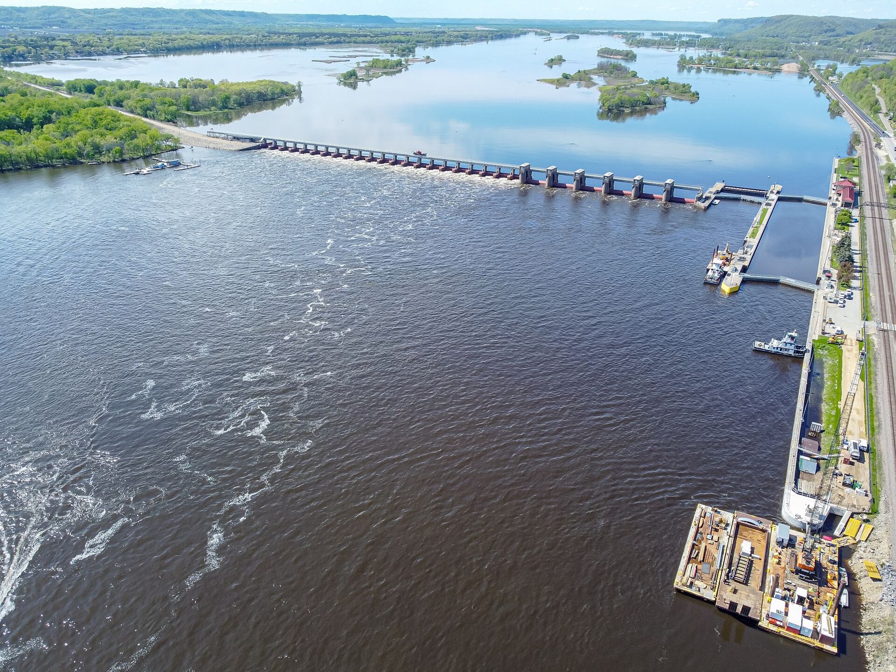
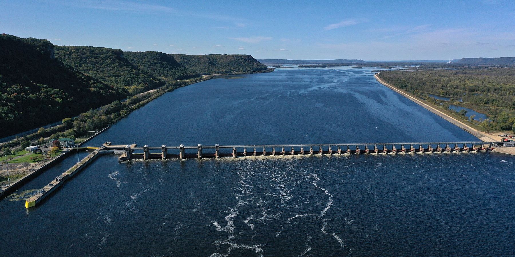
Alma's lock and dam is the reason many visitors stop. Lock and Dam No. 4 is one of the series built across the upper Mississippi in the 1930s to hold a navigable channel for barge traffic. The dam's gates span the river from the Wisconsin bank toward Minnesota, and the lock chamber lies close against the town.
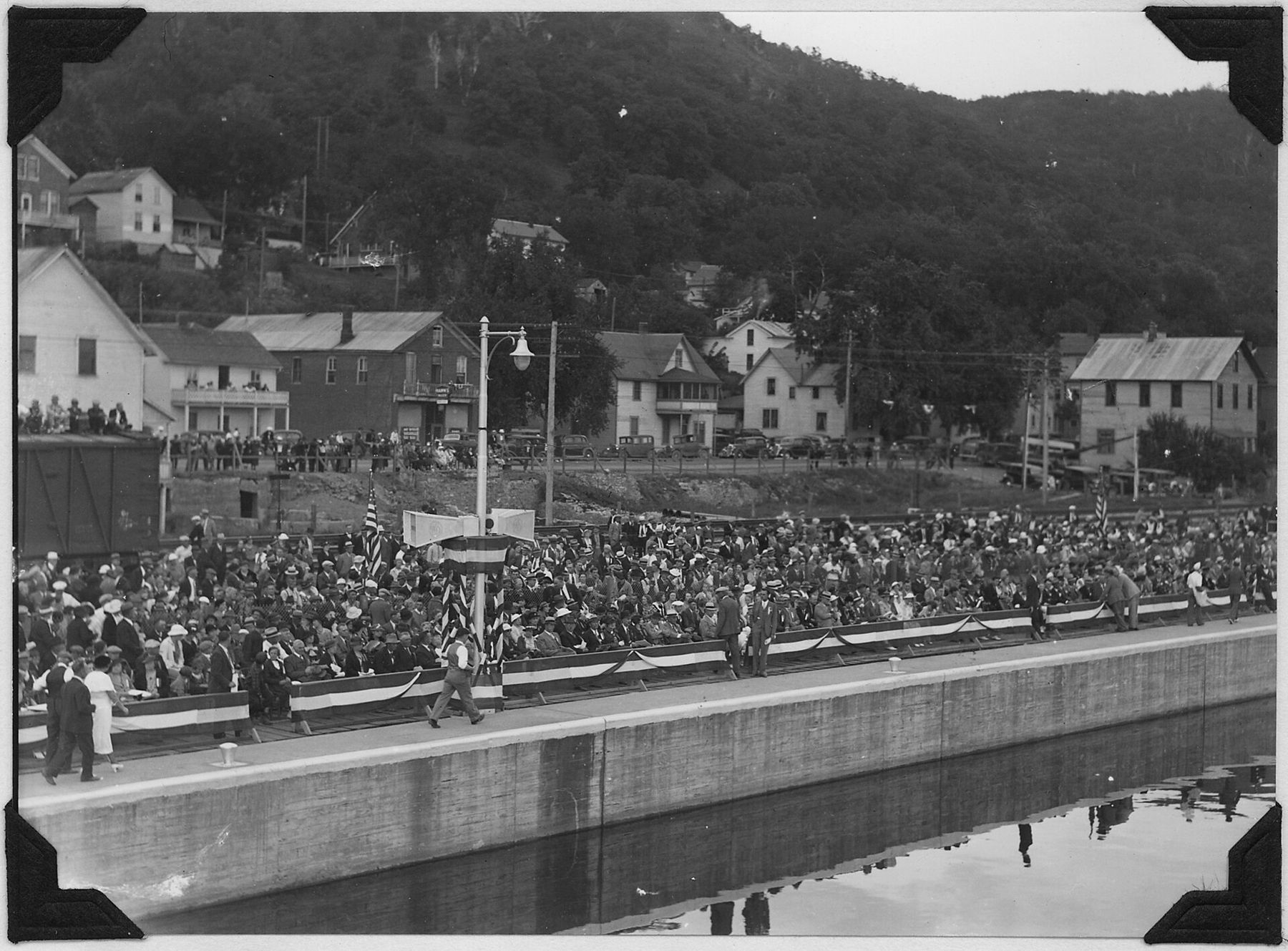
A public observation platform beside the lock, reached on foot from the main street over the railway, puts you right above the chamber. When a towboat comes through pushing a raft of barges, you can watch the whole process up close: the gates swinging, the water rising or falling, the crew walking the barges and the deckhands calling distances. Larger tows are too long for the chamber and have to be split and locked through in two parts, which takes time. Bring patience and a jacket.
When a towboat comes through pushing a raft of barges, you can watch the whole process up close: the gates swinging, the water rising or falling, the crew walking the barges and the deckhands calling distances.
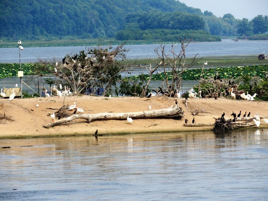
The water just below the dam stays open in winter, and like the open water at Wabasha, it draws bald eagles that come to fish in the turbulence. On a cold, clear morning from December to early March you may see them perched in the cottonwoods along the shore or dropping onto the water. For more on watching them well, read about eagles on the open water. For how the whole system of locks and dams works, there is more in its own story.
Buena Vista Park and the view
Above Alma, at the top of the bluff, Buena Vista Park offers one of the widest views on the upper river. A road climbs to it from the town's north end, and there is also a walking route up from below for anyone who wants to earn the view.
From the top you look straight down on Alma's rooftops and the lock, and then out over the whole valley: the main channel, the maze of islands and backwaters, the Minnesota bluffs across the way and, on a clear day, the river running off toward the horizon in both directions. Sunset here is popular for good reason. Stay behind the railings and away from the open edges, which drop steeply.
Just north of Alma, Rieck's Lake Park is worth a stop in autumn. Tundra swans pause on the shallow lake on their way south, often in large numbers, and a viewing platform lets you watch without disturbing them. Timing varies with the weather each year, so check local reports before you make a special trip.
Getting there and getting across
Highway 35 runs the length of the Wisconsin shore and is the obvious way in, from Pepin to the north or Fountain City to the south. From Minnesota, cross the Wabasha–Nelson bridge and you are in Nelson within minutes; Alma is a short drive further south.
Further down, Lock and Dam No. 5 holds the river in the next pool, and the bluffs on both banks keep their height all the way toward Winona. A day spent on this stretch can easily take in Wabasha on the Minnesota side in the morning, the bottoms at Nelson at midday, and the lock and the overlook at Alma toward evening.
Respect the river wherever you stand. The current below a dam is strong and unpredictable, and the water is colder than it looks for much of the year. Stay out of posted areas near the dam, keep well clear of tows, and never anchor or swim near the lock approach.
Spring brings high water most years, and the bottoms around Nelson can flood well into the trees. Autumn is the best season for most visitors: the bluffs turn, the swans arrive, and the towboats are still running before the river closes to navigation for the winter. If you come in the cold months, come for the eagles and the open water, dress for wind off the river, and check road conditions on the bluff roads before you drive up to the overlook.