- Best months
- May, June, and October
- Getting there
- US-61 or Minnesota Highway 43
- Bring
- Walking shoes, a camera and a jacket for the overlook
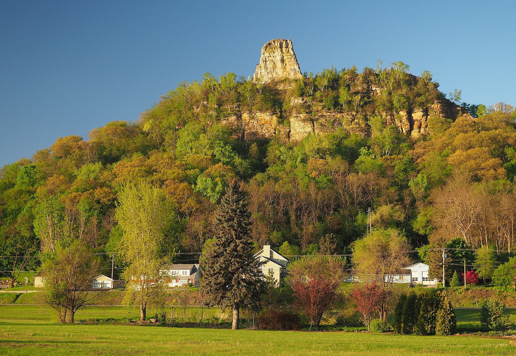
Winona is the largest town in the stretch of river this guide covers on the Minnesota side, and the strangest in its setting. It is built on a long sandbar in the Mississippi valley, with the river on its north side and Lake Winona, an old backwater channel, on its south. Behind the lake rise the bluffs, and on top of the bluffs is the view that explains the whole place.
The name comes from the Dakota word for a firstborn daughter. Before the town, a Dakota village led by the Wapasha line stood near here on the river prairie. Then came the steamboats and the lumber trade, and for a while in the late nineteenth century Winona was one of the richest towns for its size in the country, sawing logs floated down from Wisconsin's pine forests.
Garvin Heights
Garvin Heights Park sits on the bluff top above the south side of town, reached by a winding road that climbs from the valley floor. From the parking area a short paved path leads through the trees to the overlook, a terrace at the very edge of the bluff. It is an easy walk, and the reward is out of proportion to the effort.
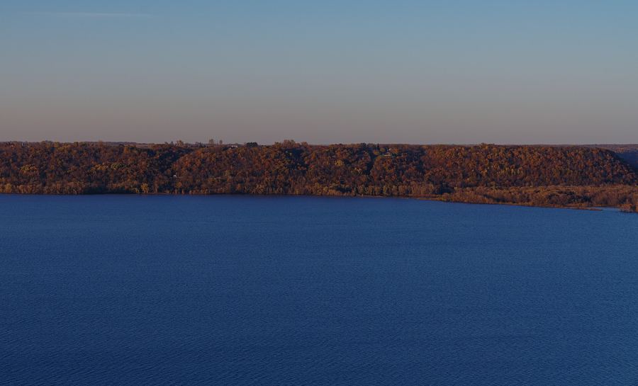
The view takes in everything at once. Directly below lies Lake Winona, with paths around its shore. Beyond that is the town on its sandbar: church spires, the old brick downtown, the campus buildings and the long line of the levee. Then comes the Mississippi, wide and braided with islands, the Winona bridges crossing it, and the Wisconsin bluffs rising on the far side. On a clear day you can follow the river valley for miles in both directions.
Footpaths lead off from the overlook along the bluff top through oak woods and patches of goat prairie, the steep, dry, south-facing grassland that clings to bluffs all through this country. In late summer the prairie is full of tall grasses and wildflowers, and hawks ride the updrafts along the bluff face. The trails are short and unmarked in places; stay well back from the edge.
Go at sunset if you can, when the low light catches the far bluffs and the town lights come on below. The overlook has railings, but the bluff falls steeply beyond them; keep children close and stay behind the barriers.
Sugar Loaf
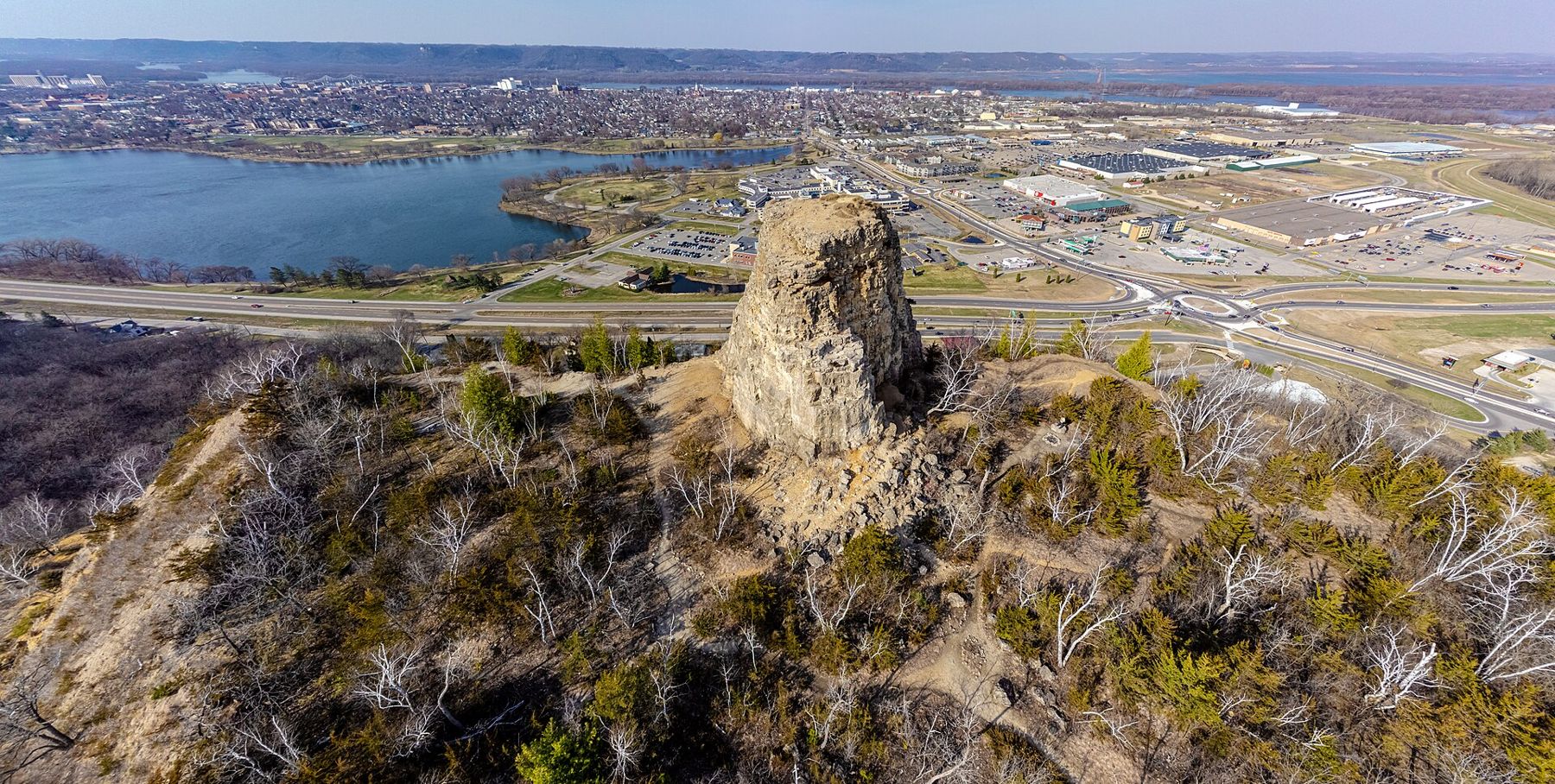
Sugar Loaf is the landmark you see from almost everywhere in town, a tall, square-sided pinnacle of rock on top of a bluff at the east end of Lake Winona. It looks natural, but its shape is partly the work of people: quarrymen cut stone from this bluff in the nineteenth century and left the pinnacle standing. The Dakota knew the bluff long before, and local stories link it to the Wapasha leaders whose people lived below.
Trails on the bluff lead up toward the base of the pinnacle, and from up there the view looks back along the lake to the town. The climb is short but steep, and the ground around the rock is loose and crumbling. Stay off the pinnacle itself and keep to the trail. If you prefer to admire it from below, the walk around Lake Winona gives you a good look at Sugar Loaf from several angles.
Go at sunset if you can, when the low light catches the far bluffs and the town lights come on below.
Around Lake Winona
Lake Winona is split into an east and a west lake, and a paved path runs around both. It is the town's backyard: people walk dogs, run, push strollers and cycle the loop at every hour, and there are fishing piers, picnic shelters and benches all along the shore. The path is flat and easy, with the bluffs rising beyond the water and Sugar Loaf standing above the east end.
 Further along the riverBluff colour, week by week
The lake is good for birds, too. In spring and autumn migrating ducks, grebes and pelicans rest on the open water, and in summer herons stalk the shallows. If you want a simple hour in Winona without a car, park near the lake and walk part of the loop.
The river town
Winona's downtown has some of the finest late-nineteenth-century commercial buildings on the upper Mississippi, built with lumber and grain money. Walk the streets near the river and look up at the carved stone, ornate cornices and tall windows. Stained glass is one of the town's quieter trades: studios here have made and restored windows for churches and buildings around the country for generations, and you can spot their work in churches around town.
Near the river, the Minnesota Marine Art Museum holds a collection of art inspired by water, from river scenes to seascapes, in a building on the riverbank. The Winona County Historical Society museum covers the steamboat and lumber years, and Levee Park along the river is a good place to watch towboats and imagine the steamboat landing in its busiest days.
The lumber years shaped the town. Logs cut in the pine forests of Wisconsin and Minnesota were floated down the rivers in huge rafts, and Winona's sawmills turned them into boards that built farmhouses and towns across the treeless prairies to the west. The mill owners built big houses and handsome churches, and when the pine ran out around the end of the nineteenth century, the town turned to other trades. The houses remain, and a walk through the older residential streets near the lake shows how much money passed through here.
The river itself is still busy. Towboats push barges of grain and other bulk cargo past the levee, and in summer pleasure boats tie up in the harbours along the shore. Latsch Island, across the main channel, has a row of floating boathouses, a long Winona tradition of small homes and workshops built on rafts. Look at them from the bridge or the shore; they are private.
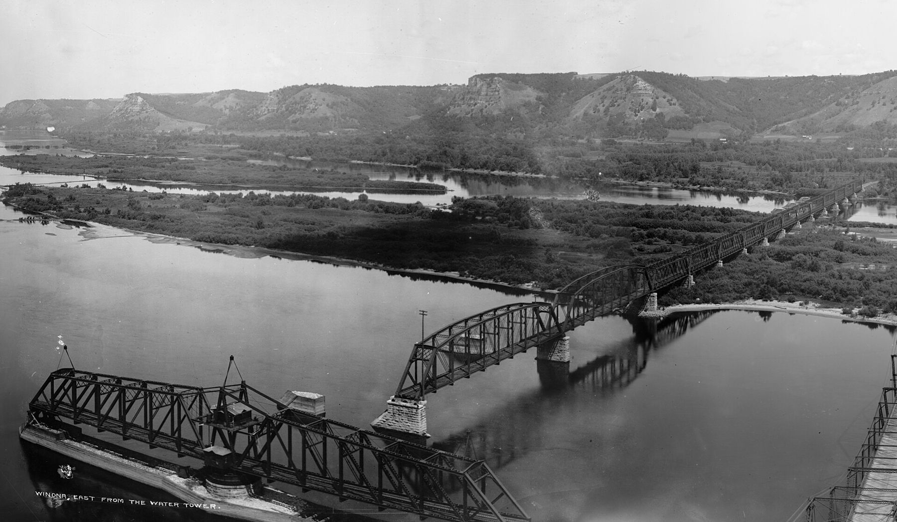
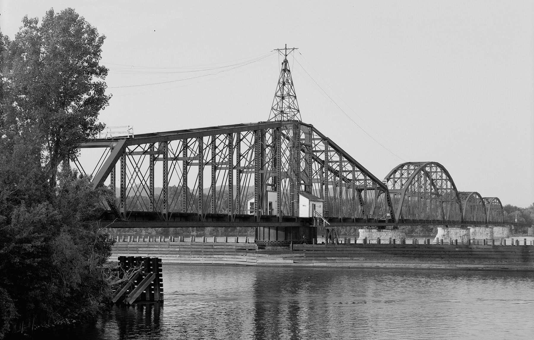
Bridges have always mattered here. In the late nineteenth century bridges with swing spans crossed the main channel, opening to let steamboats through. Old photographs show how wild the river was then, a wide channel among low islands with the Wisconsin bluffs bare and grassy across the valley. Today the highway bridges on Minnesota Highway 43 carry traffic over to the Wisconsin side.
Across the river
The Winona bridges lead across the main channel and the islands to Wisconsin Highway 35. Turn north and the road follows the river to Fountain City, a village of houses stacked up the face of the bluff. Turn south and you reach Perrot State Park and Trempealeau, where Brady's Bluff gives a view to match Garvin Heights and Trempealeau Mountain stands alone in the river.
From Winona it is easy to make a day of both banks: Garvin Heights in the morning, lunch in town, then across the river for an afternoon on the bluffs of Perrot. The Great River Road on both banks covers the crossings in more detail.
A few practical notes. Garvin Heights Park and the bluff trails are open in season, and the road up can close in winter; check before you drive up in snow. Museum hours and admission change, so look them up. And give yourself time on the lake path: Winona is best understood slowly, from the water's edge as well as from the top of the bluff.
Whose pictures these are
- McGhieverCC BY-SA 4.0
- Wikideas1CC0
- Detroit Publishing Co.Public domain
- HAER MINN, 85-WIN, 1--9Public domain