- Best months
- April to June, or September
- Getting there
- Highway 35 to Alma's lock viewing platform
- Bring
- Binoculars, patience and a jacket for the wind
- When
- April, May, June
A river turned into a staircase
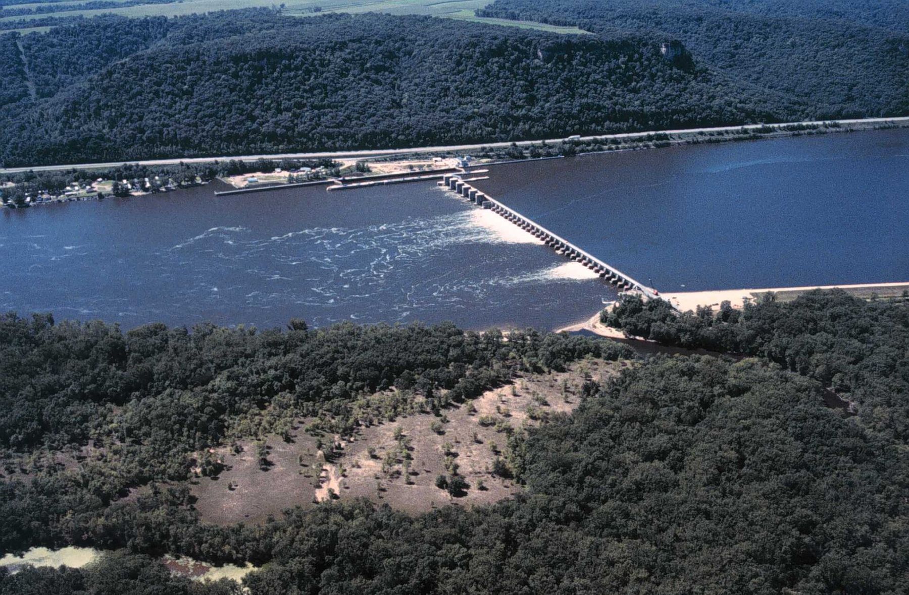
The Mississippi you see between Red Wing and La Crosse is not a free-flowing river. It is a series of long, flat pools, each held back by a low dam and stepping down to the next. The system was built mostly in the 1930s, when the federal government set out to give the Upper Mississippi a reliable navigation channel at least nine feet deep so barges could move grain and other cargo up and down the river. Before then, shallow bars and low water in late summer made commercial travel uncertain.
Each dam raises the water behind it. Each lock lets boats climb or descend the step. In this stretch the system runs from Lock and Dam 3 above Red Wing down through Lock and Dam 4 at Alma, Lock and Dam 5 near Minneiska, Lock and Dam 5A above Winona, Lock and Dam 6 at Trempealeau and Lock and Dam 7 near La Crescent. Lake Pepin, a natural lake, needed no dam of its own.
The pools changed the river. They drowned old channels and islands and created the wide backwaters, marshes and sloughs that now make up much of the Upper Mississippi River National Wildlife and Fish Refuge. Much of what visitors think of as the natural river is, in part, a product of the dams.
How a lock works
A lock is a concrete chamber with gates at each end. To go downstream, a boat enters the chamber at the upper pool level, the upstream gates close, and valves let water drain out until the level matches the pool below. The downstream gates open and the boat moves on. Going upstream, the process runs in reverse. No pumps are involved. Gravity does all of it.
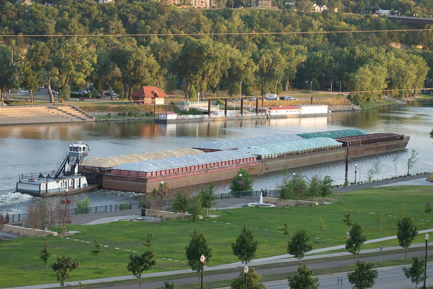
The main lock chambers on this stretch are 600 feet long. A large towboat often pushes a raft of fifteen barges lashed together, which is longer than the chamber. Those tows have to split in two. The crew unhooks the front barges, they are locked through and pulled out with a winch, then the towboat and the rest of the barges follow, and the whole tow is put back together below the lock. It takes time, and it is the most interesting thing to watch at a lock.
Pleasure boats, canoes and kayaks also lock through, usually waiting until commercial traffic has been handled. If you plan to paddle or boat through a lock, learn the signals and procedures first, wear a life jacket and follow the lock staff's instructions.
Where to watch from shore
Lock and Dam 4 at Alma is the easiest place in this stretch to watch a lock at work. A public viewing platform sits beside the lock, right off Wisconsin Highway 35, and from it you look straight down into the chamber. Alma is a small town strung along the highway between the bluff and the river, and you can walk from the platform to Buena Vista Park, high on the bluff above town, for a view of the whole pool.
 Further along the riverEagles on the open water
Other locks along the river have areas where you can watch from the shore, though access and facilities vary and sometimes change for security or construction. Check before you go. On the Wisconsin side, the villages around Fountain City and Trempealeau sit close to Locks and Dams 5A and 6. On the Minnesota side, US-61 runs near several of the dams, and overlooks such as Garvin Heights at Winona show the river and its pools spread out below.
There is no timetable for tows. Traffic depends on the season, the river level and what is being shipped. If you arrive and nothing is moving, look up and down the river. A tow on the way can often be seen well before it reaches the lock, and the lock crew's preparations are a good sign that one is coming.
The river's working season
Navigation on the Upper Mississippi follows the ice. In winter the upper river freezes and commercial traffic largely stops. Lake Pepin, wide and slow, is usually one of the last places to clear in spring, and the first tows to push through it each year are a sign that the river's working season has begun. Traffic builds through spring and summer and carries on until ice closes the river again in late autumn or early winter.
Much of the downstream cargo is grain from the farms of the Upper Midwest, heading toward ports on the Gulf. Upstream tows bring other goods back. Barges move a great deal of freight with relatively little fuel, which is why the river still matters to farmers and shippers long after the steamboat age ended.
River safety around tows and dams
If you are on the water, give tows and dams a wide berth. A loaded tow is enormous and cannot stop or turn quickly. The pilot may not be able to see a small boat or a canoe close to the front of the barges at all. Stay out of the main channel where you can, cross it quickly and at right angles, and never pass close in front of a moving tow.
The water just above and below a dam is dangerous. Currents near the gates are strong, and turbulence below them can trap a person or a boat. Restricted areas are marked with signs and buoys. Stay out of them, whatever the fishing looks like. Big wakes from towboats and pleasure boats can swamp a canoe or knock you off your feet on a sandbar, so watch for them and turn into them.
Seeing the system whole
For a good half-day, drive Wisconsin Highway 35 to Alma, spend some time at the Lock and Dam 4 platform, then climb to Buena Vista Park and look down on the pool you have just watched a tow leave. Cross back to Minnesota on the Wabasha–Nelson bridge or farther south at Winona, and you will see the same staircase of pools from the other bank. Seen from above, the river's design is clear: long, flat water, a line of gates, and another long pool below.
Whose pictures these are
- USGSPublic domain
- Pete Markham from Loretto, USACC BY-SA 2.0