- Best months
- May, June and October
- Getting there
- US-63 to Hager City, then Highway 35
- Bring
- Binoculars, sturdy shoes and a layer for the lake wind
Drive Wisconsin Highway 35 south from Hager City and the road soon gives up on straight lines. It bends with the shore of Lake Pepin, squeezed between a wall of wooded bluff on one side and open water on the other, and every few miles it threads a village that grew up wherever a ravine or a creek mouth left just enough flat ground for a street. Bay City comes first, near the head of the lake. Maiden Rock follows, tucked under the cliff that gave it its name. Neither takes long to see. Both reward the slow version of the trip.
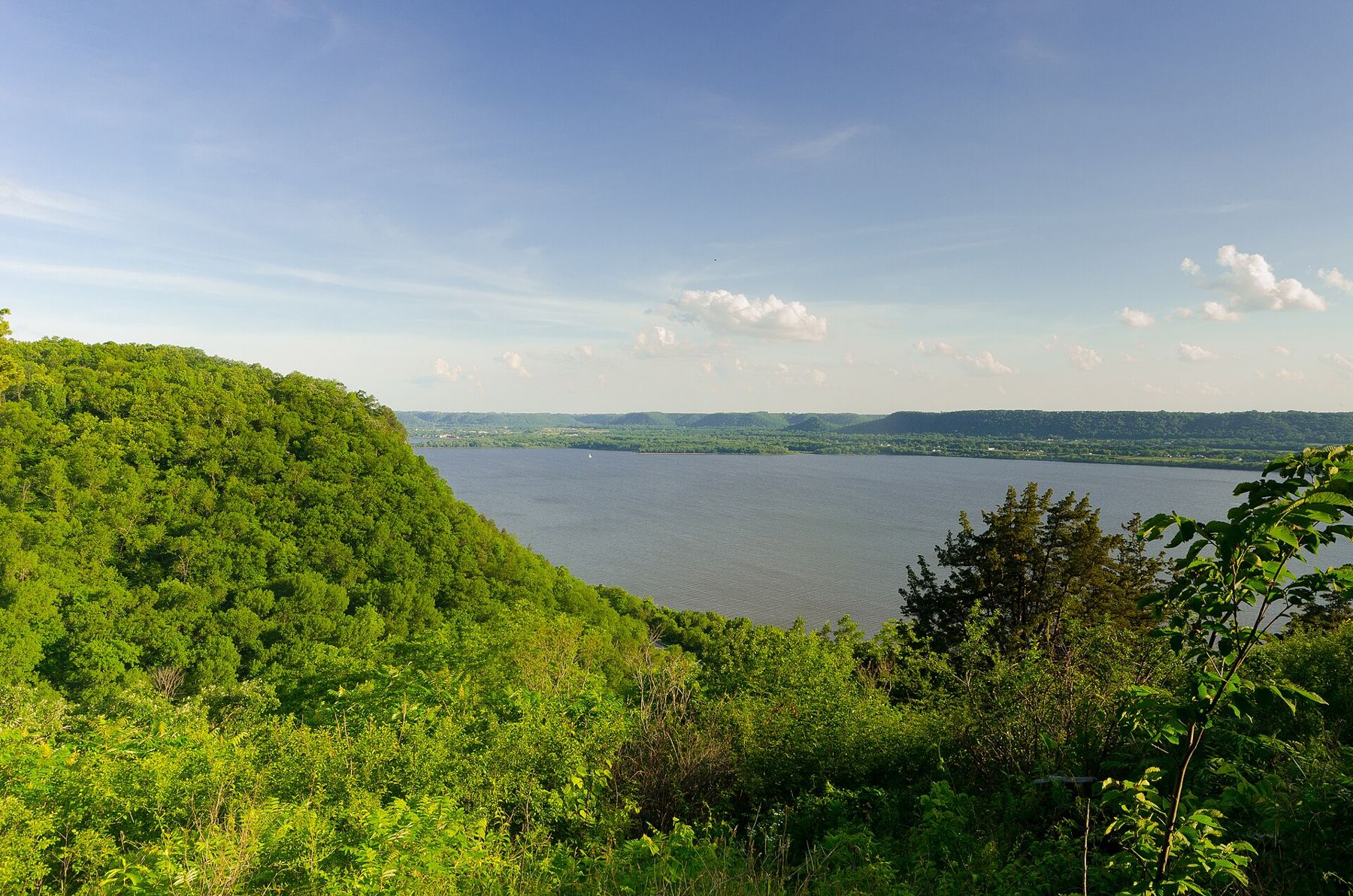
This is the Wisconsin shore of the upper lake, and it looks straight across at Minnesota. On a clear day you can pick out the bluffs above Red Wing to the northwest and the long, dark line of the Minnesota shore running down toward Frontenac. The lake is wide enough here that weather crosses it in visible sheets, and the view changes by the hour.
Where the river becomes a lake
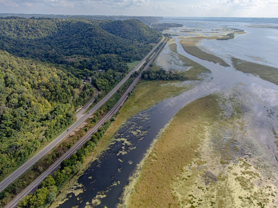
Lake Pepin is not a reservoir. It is a natural widening of the Mississippi, formed where the Chippewa River, coming in from Wisconsin at the lower end of the lake, has dropped so much sand over thousands of years that its delta partly dams the bigger river. Behind that natural dam the Mississippi backs up into a lake more than twenty miles long and over two miles wide at its broadest.
The head of the lake, where the current slows and the channel spreads out, sits around Bay City. Upstream, the river is still a river, braided with islands and backwater sloughs. Downstream, it opens into the long sheet of water that sailors, anglers and ice fishers all treat as their own small sea. From the shore at Bay City you can see both moods at once: the moving channel to the north and the broad, wind-ruffled lake to the south.
Bay City is a small village with a public landing and a lakeside park, and it is the easiest place on this stretch to put a canoe or a small boat in the water. The shallows near the head of the lake hold fish and birds in good numbers, and the marshy edges are worth a slow paddle in calm weather. Remember that the lake is big enough to build real waves when the wind runs along its length. Small boats should stay near shore and head in early when the afternoon wind picks up or a storm line shows over the Minnesota bluffs.
Highway 35 under the bluffs
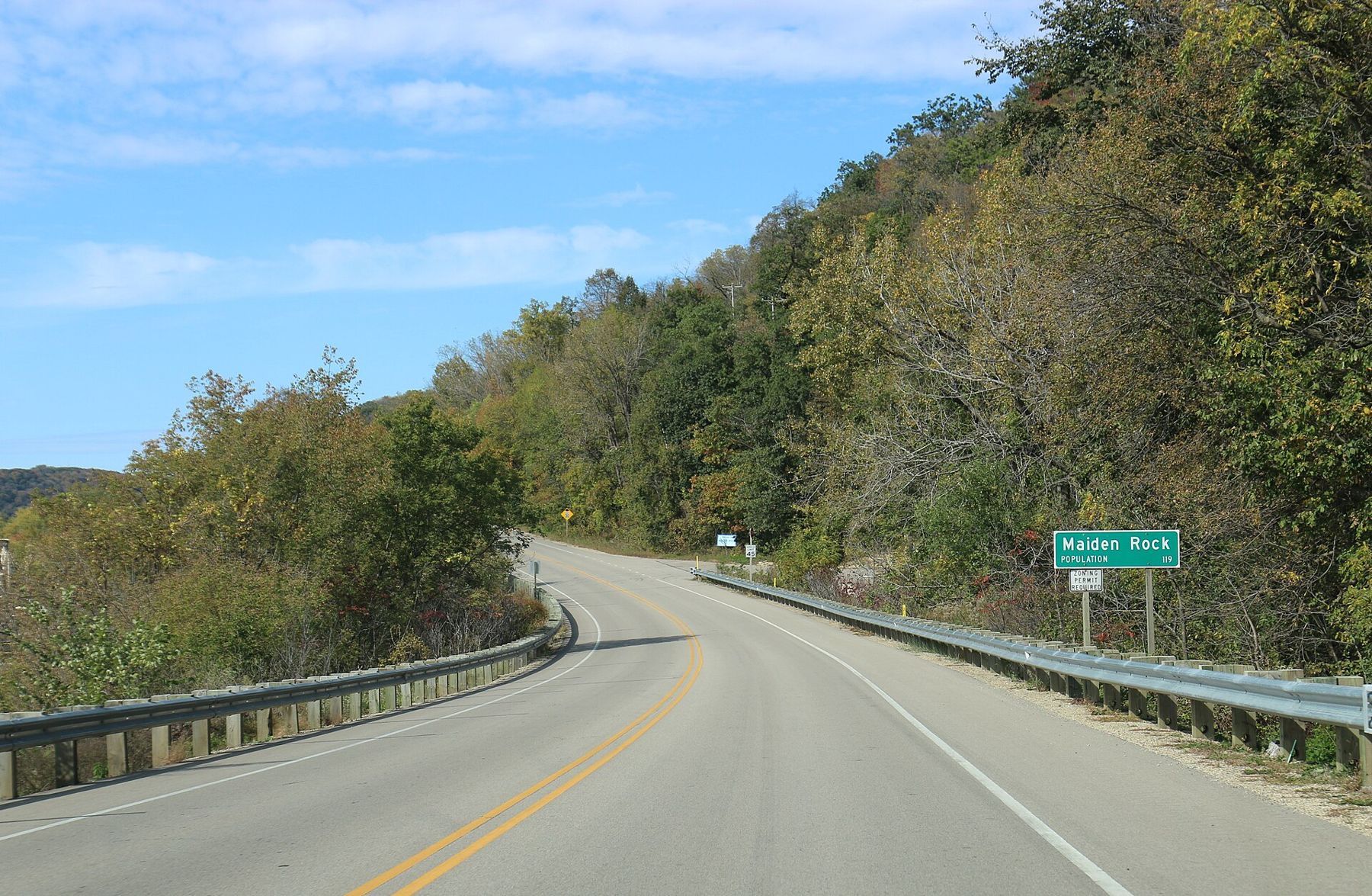
Between the two villages the highway runs on a narrow shelf. The bluffs rise several hundred feet on the inland side, oak and basswood on the slopes, pale limestone and sandstone showing in the steeper faces. On the lake side there is often only a guardrail, the railway and a strip of brush between you and the water. Pull-offs are few, so use the ones that exist rather than stopping on the shoulder, and watch for cyclists, who like this road as much as drivers do.
Between Bay City and Maiden Rock, the Rush River comes down out of its valley to meet the lake. The Rush is one of the better-known trout streams on the Wisconsin side, and the road up its valley makes a good detour into the coulee country behind the bluffs. Its mouth, where it has pushed a small delta out into Lake Pepin, is a reliable place for herons, egrets and migrating ducks.
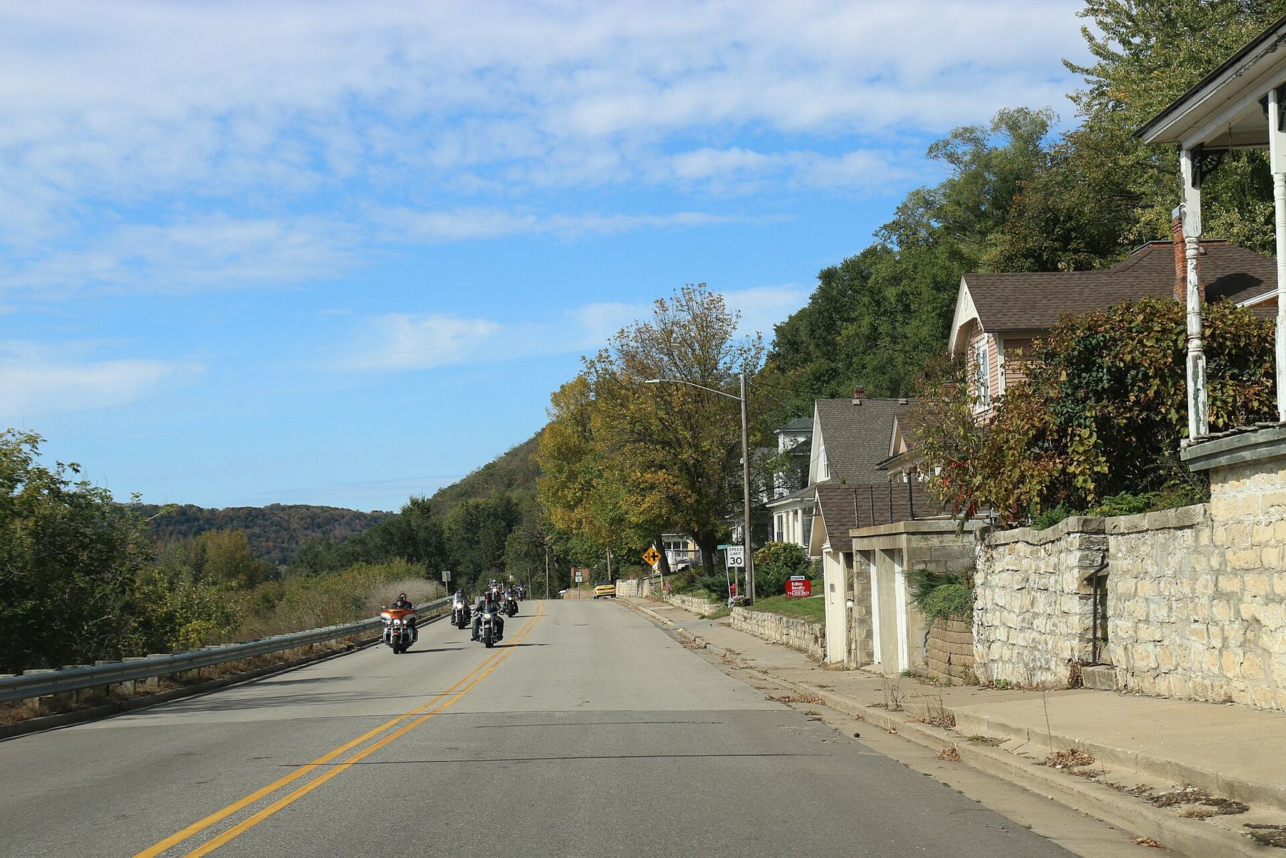
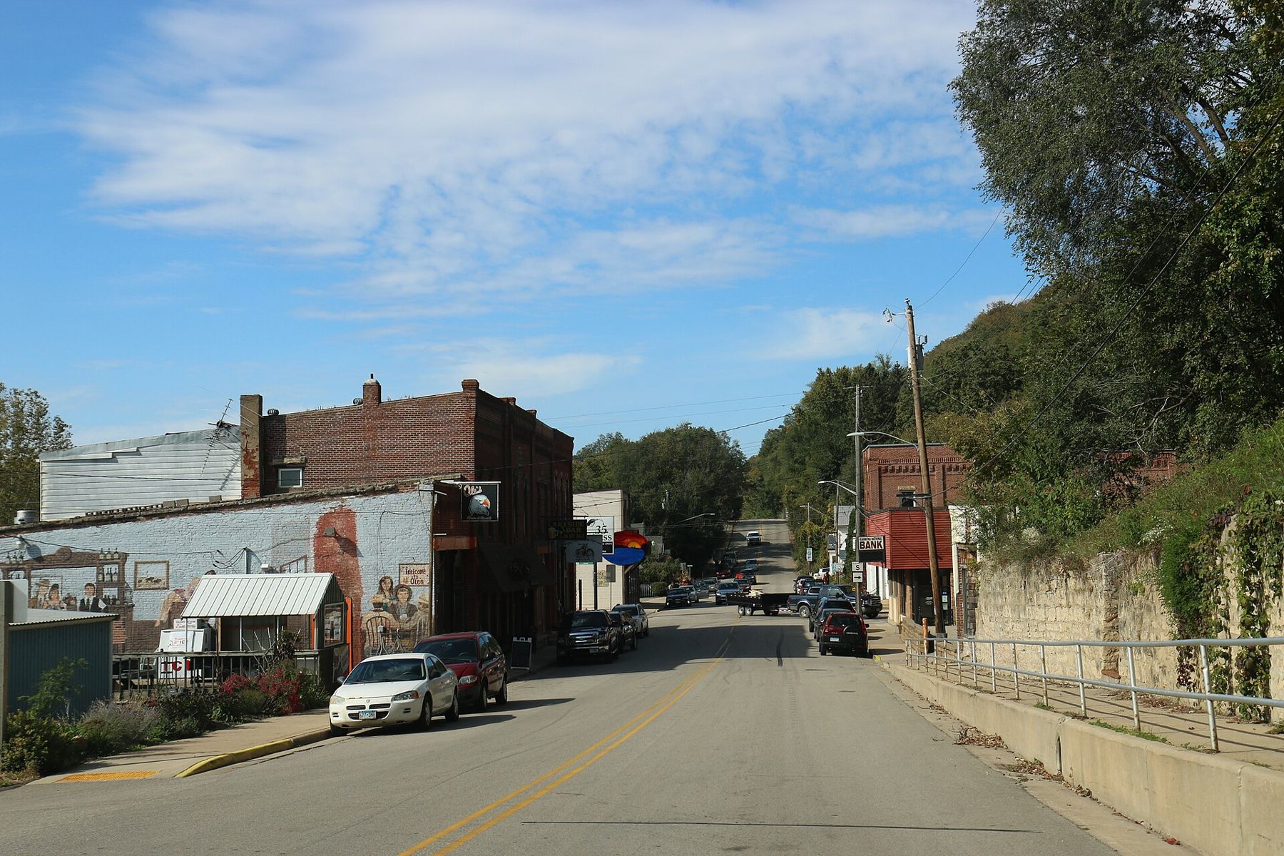
Maiden Rock village is a single main street strung along the highway, with old stone walls holding back the slope behind it and houses climbing the hill in tiers. It has the look of a place that has always lived with the bluff at its back door. The lake is right there, just across the tracks.
The bluff and the legend
Just south of the village, a sheer face of rock stands high above the lake. This is Maiden Rock, and the story attached to it is the most retold legend on this part of the river.
The usual telling goes like this. A young Dakota woman, most often named Winona, was promised by her family to a man she did not want to marry. Rather than accept the match, she climbed to the top of the cliff and leapt from it. In some versions she loved another man; in others the reason is simply that she refused to be given away. The details shift from one telling to the next, and so does the name of the man and the season of the year.
It is worth holding the story at a careful distance. It reached print largely through nineteenth-century travellers, missionaries and writers, who heard it secondhand, retold it in their own words and often added a romantic gloss. Mark Twain included a version in Life on the Mississippi and turned it into a joke. No record settles whether any such event happened, and Dakota people have their own ways of remembering this landscape that do not always match what ended up in print. Treat it as what it is: a legend about a real place, told for well over a century and shaped by many hands.
Treat it as what it is: a legend about a real place, told for well over a century and shaped by many hands.
What is not legend is the rock itself, and the land on top of it.
 Further along the riverThe Great River Road down both banks in two days
Maiden Rock Bluff State Natural Area
The top of the bluff is protected as Maiden Rock Bluff State Natural Area. Its value is not only the view. The exposed cliff and the dry prairie along its upper edge hold plants that need thin soil and full sun, and the cliffs are known as a nesting place for peregrine falcons, which have returned to the river bluffs after their numbers crashed in the twentieth century.
You reach the natural area from the upland side, not from Highway 35 below, by following local roads up out of the valley to a small parking area and then walking out to the bluff. The state publishes directions and any rules for the site, and it is worth checking them before you go, since access details can change.
Out on top, the path leads through woods and prairie to open ground at the edge. The view runs down the length of Lake Pepin and across to the Minnesota bluffs, with the highway and rail line looking like pencil lines far below. It is one of the best places on either bank to understand the shape of the valley: the river spread into a lake, the wall of bluffs on both sides and the flat farmland on the uplands behind them.
Be plain with yourself about the edge. There are no railings, the rock can be loose, and the drop is sheer. Keep children close and dogs on a leash, stay well back from the lip, and do not climb out onto ledges for a photograph. In wet weather, the grass near the edge is slick.
Across the lake to Red Wing
Bay City and Maiden Rock face Minnesota across open water with no bridge between them. The nearest way over is the US-63 bridge at Red Wing, which reaches the Wisconsin side at Hager City, a short drive north of Bay City. That makes it easy to pair the two banks in a single day: climb Barn Bluff in the morning, cross the river, and drive Highway 35 down to Maiden Rock in the afternoon light.
Looking back across the water, the Minnesota shore around Frontenac is just as wooded and just as steep. Each bank is the other's view. From the top of Maiden Rock you look at the Minnesota bluffs; from the bluff trail at Frontenac you look back toward this side of the lake. Keep driving south on Highway 35 and the next village is Stockholm, smaller still.
When to go and what to expect
May and June bring warblers along the bluff edges and the first full green on the slopes. Summer is sailing season, and on a breezy weekend the lake fills with white sails; if that appeals, read up on sailing Lake Pepin before you rent or launch anything. Late September and October are the busiest weeks on this road, when the oaks turn bronze and the maples go red against the water. Weekdays are much quieter than weekends then.
Winter is stark and quiet. The lake usually freezes, and in a cold year you will see ice fishing shelters out from the shore. Ice thickness varies a great deal on Lake Pepin because of current and springs, so follow official advice and local knowledge, and never assume ice is safe because someone else is standing on it.
Services along this stretch are thin. The villages have a few places to eat, but hours are seasonal and change often, so check before you rely on any of them, and fill your tank in Red Wing or another larger town before you set out.
Whose pictures these are
- Joshua Mayer from Madison, WI, USACC BY-SA 2.0
- RoyalbroilCC BY-SA 4.0