- Best months
- May, June, and October
- Getting there
- US-61 south from the Twin Cities
- Bring
- Good shoes for the bluff stairs and water
Red Wing is where the bluff country starts in earnest. Drive down US-61 from the Twin Cities and the land is mostly flat farm country until the road drops toward the river and a long, steep, wooded hump of rock fills the view. That is Barn Bluff, and the town of Red Wing is wrapped around its foot, squeezed between the rock, the Mississippi and a ring of higher bluffs behind.
The name comes from a line of Mdewakanton Dakota leaders known as Red Wing, whose village stood here long before the steamboats arrived. The Dakota name for Barn Bluff is He Mni Can, the hill, water and wood, and you will see it on signs around town. It is worth knowing before you climb: this rock was a landmark and a sacred place long before anyone thought of it as a view.
Up Barn Bluff
Barn Bluff is a city park, and the main way up begins near East Fifth Street, a few blocks from downtown. A stone stairway takes you up the first steep pitch, and from there dirt trails split around the top. One path follows the south side, open and grassy, with the town below you; another works along the north face toward the river. The top is a long prairie ridge rather than a single summit, so give yourself time to walk its length.
From the river end you look straight down on the Mississippi, the Red Wing Bridge and the marina, and across to the wooded bottoms of Wisconsin. Looking the other way you see the town laid out like a map: church steeples, the brick blocks of downtown, the grain elevators by the water and the green ridges that close the valley in. Henry David Thoreau climbed the bluff in 1861 on his trip west, and visitors have been making the same climb ever since.
The trails are rough in places, with loose rock and steep edges, and the old quarry faces on the river side drop sheer. Stay on the marked paths, keep dogs and children close near the edges, and skip the climb in ice or heavy rain, when the clay turns slick. In summer, go early: the south face takes the full sun and there is no water at the top.
The brick downtown
Red Wing grew rich in the late nineteenth century on wheat, then on clay and leather. For a while it was one of the busiest wheat markets in the country, with farmers' wagons lining up to load grain onto river boats. The money built the downtown you walk through now: solid red-brick and limestone blocks, cast-iron storefronts, a grand old hotel and a city-owned theatre that opened in 1904.
The clay mattered as much as the grain. Local deposits fed stoneware works that turned out crocks, jugs and later art pottery shipped across the country, and the old pottery district on the west side of town still has its long brick buildings. Leather came next: the boot factory that carries the town's name still makes work boots here, and you will see the boot in shop windows and murals. The Goodhue County Historical Society museum, up on the hill, tells the story of the clay, the wheat and the river in more depth than any walking tour can.
The best way to see the downtown is on foot. Start at the train depot by the river, walk up Bush Street and along Main and Third, and look up: most of the detail is above the shop fronts, in carved stone, dated parapets and tall arched windows.
It is worth knowing before you climb: this rock was a landmark and a sacred place long before anyone thought of it as a view.
The levee and the river
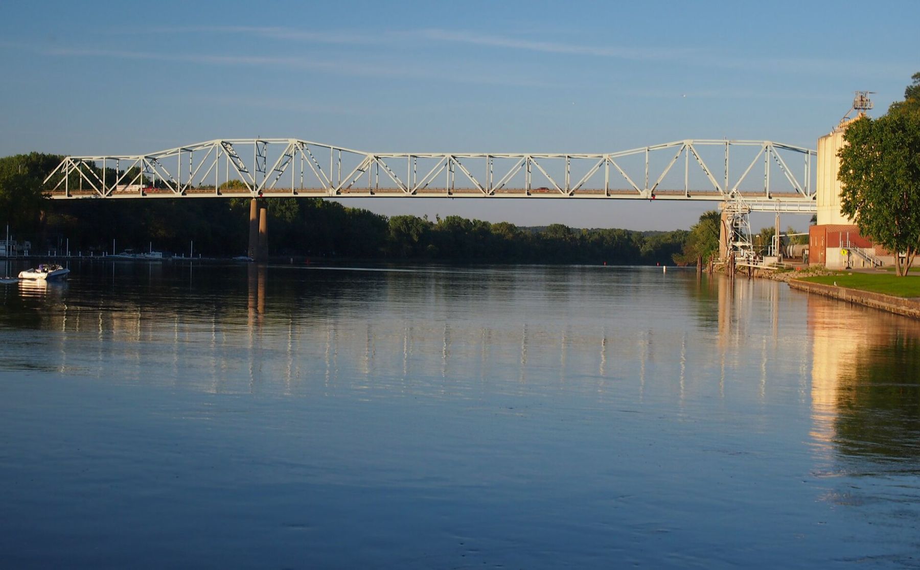
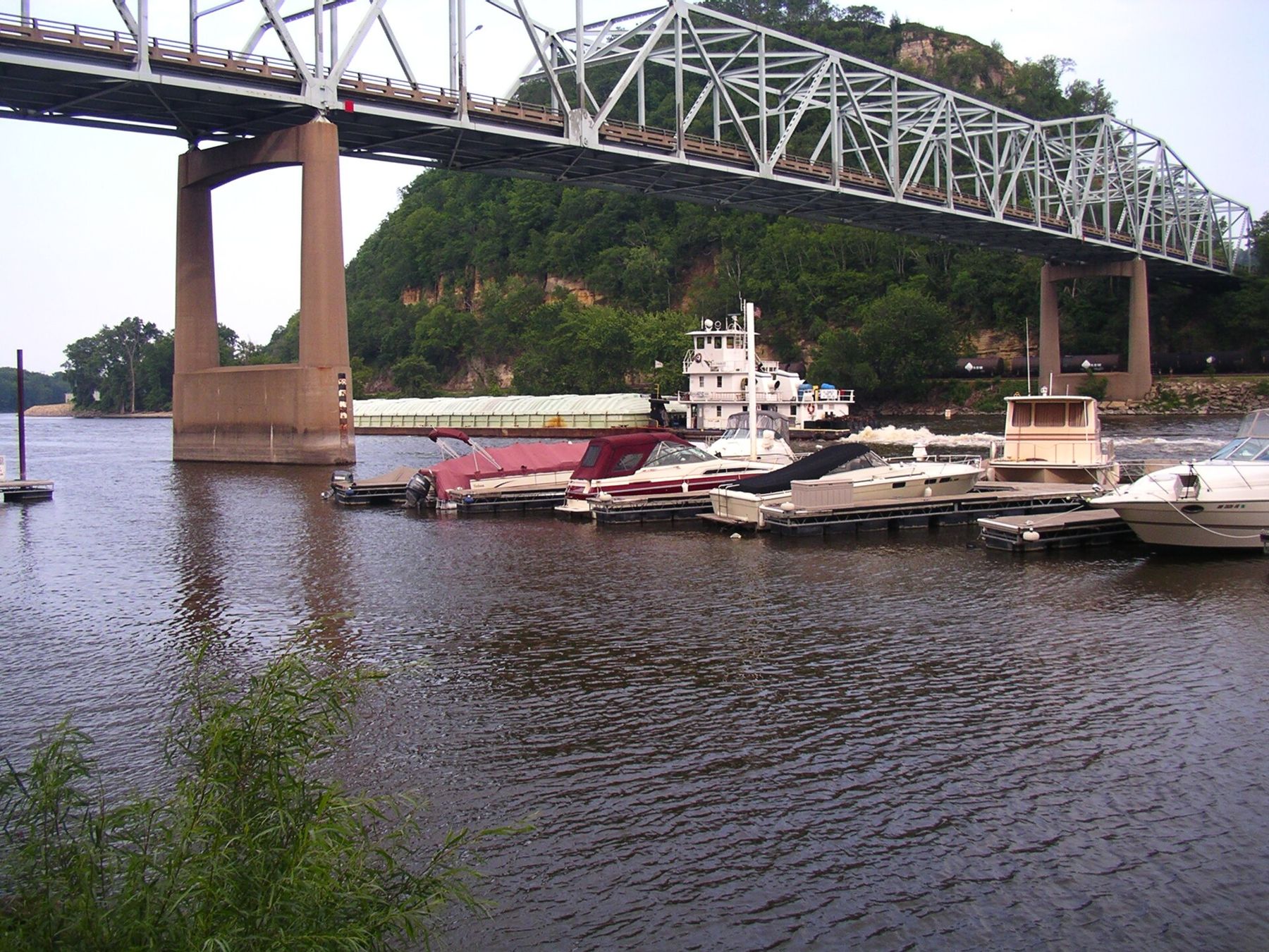
Levee Park runs along the water between downtown and the bridge, a strip of lawn, paths and benches where you can watch the river work. Towboats push long rafts of barges up and down the channel, river cruise boats tie up in season, and on a calm evening the whole stretch goes quiet enough to hear the current against the pilings. The Red Wing Bridge carries US-63 over the main channel to Hager City, Wisconsin, and from the levee you see it end on.
 Further along the riverThe Great River Road down both banks in two days
The river here is wide and fast, and it is not a swimming beach. The main channel carries commercial traffic, wakes from big boats travel a long way, and the water near the levee is deep. Watch from the bank, and if you want to be on the water, rent a boat or join a cruise run by people who know the channel.
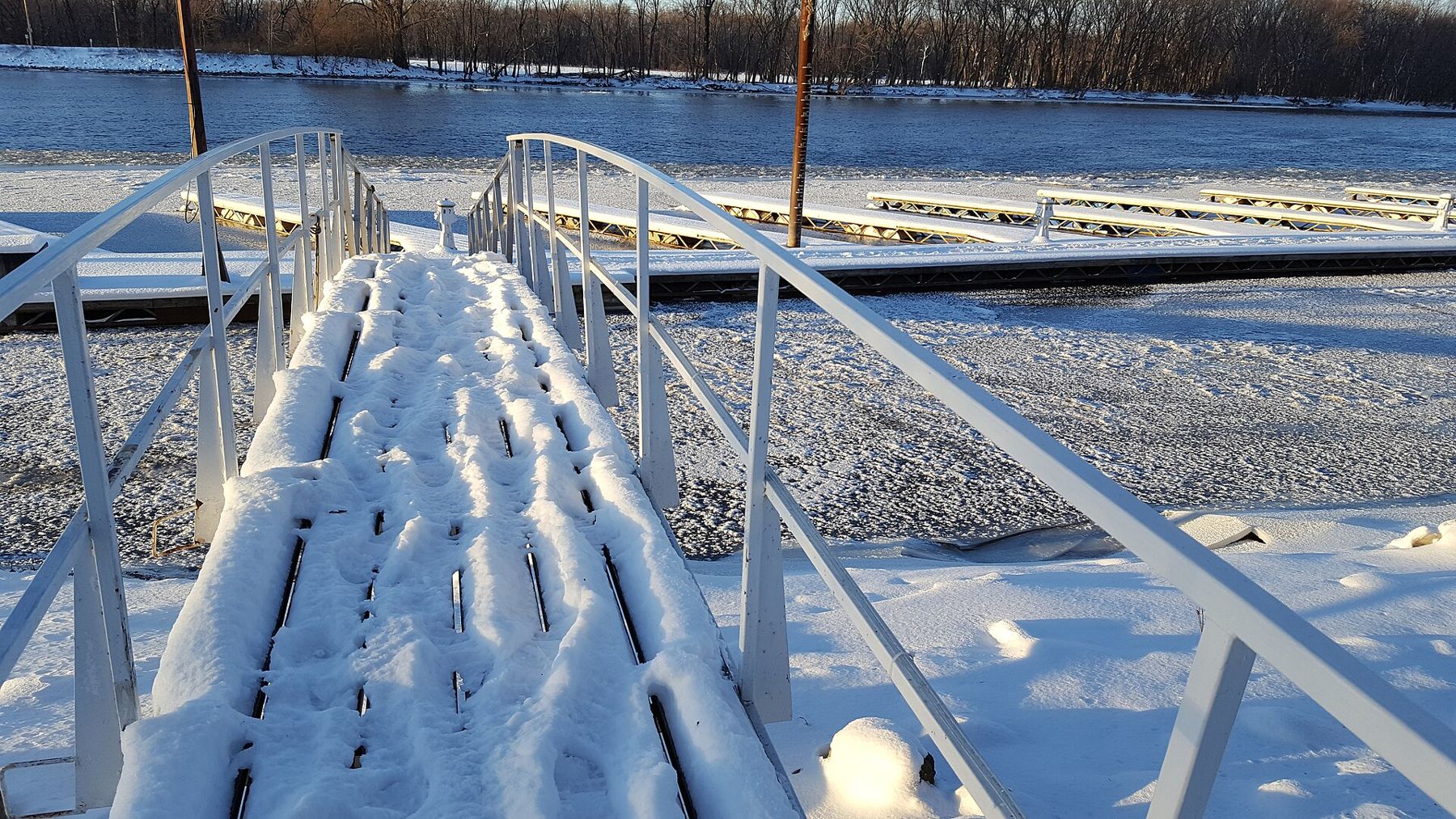
Upstream, Bay Point Park sits on the river at the western edge of town, with boat ramps, lawns and a view of the long reach toward Prairie Island. Downstream, Colvill Park has picnic grounds and paths along the water. In winter both are quieter, and wherever the river stays open you may see bald eagles fishing.
The view from the other bluffs
Barn Bluff gets the attention, but Sorin's Bluff, on the south side of downtown, has a park on top called Memorial Park, reached by a winding road and by footpaths. The views there look back at Barn Bluff and out over the whole valley, and the drive to the top is an easy option for anyone who cannot manage stairs. On a clear October afternoon, with the oaks gone copper on every slope, it is hard to find a better seat in the region.
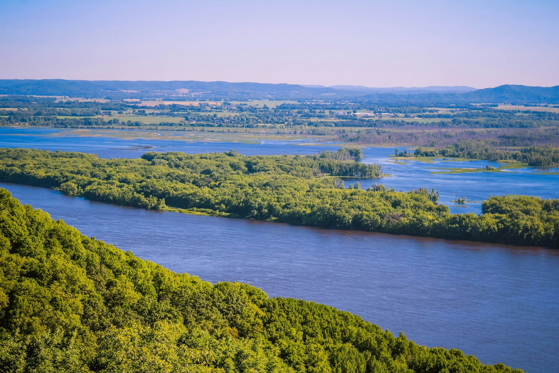
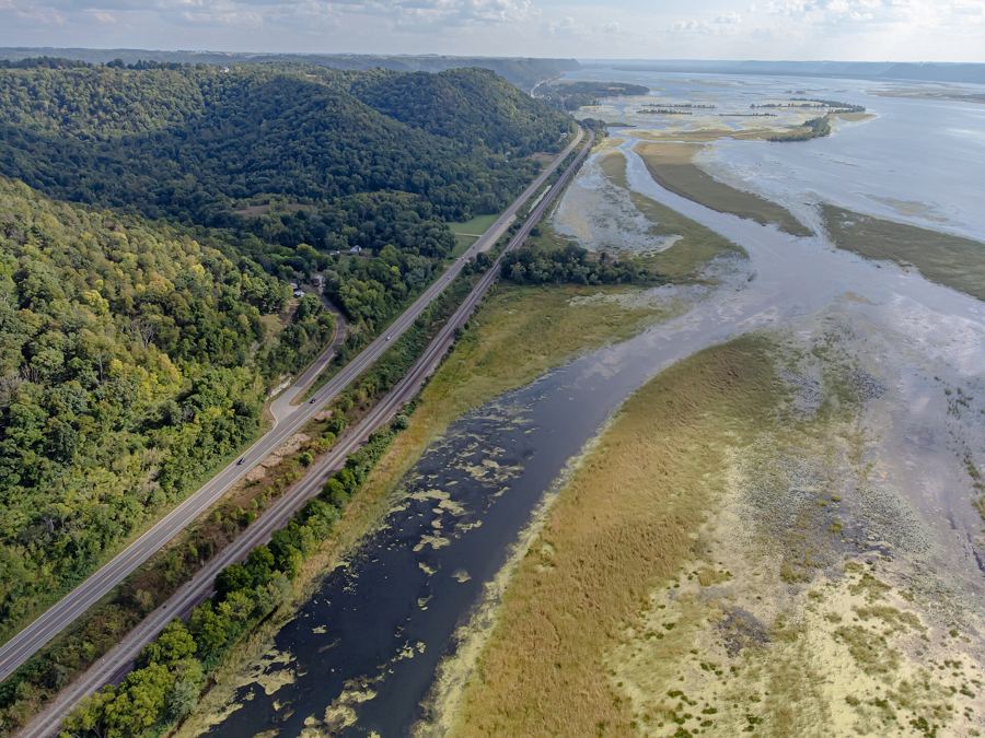
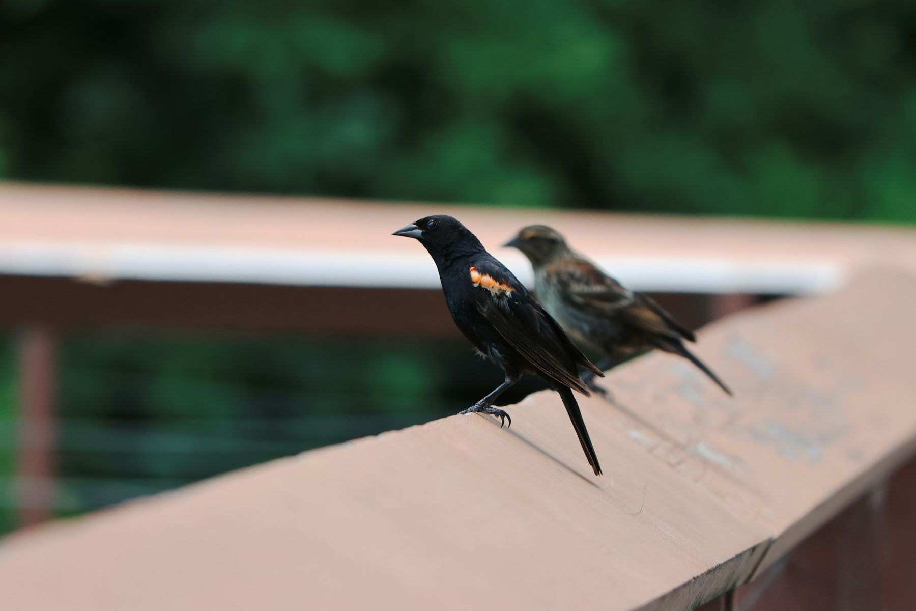
From either bluff you can read how this valley works. The main channel runs close under the bluffs, while on the far side a maze of islands, sloughs and marsh spreads toward Wisconsin. That backwater is part of what makes this stretch of river so good for birds: herons, pelicans, ducks and the red-winged blackbirds that call from every cattail patch in spring.
Trails out of town
Red Wing is the eastern end of the Cannon Valley Trail, a paved path on an old rail bed that follows the Cannon River upstream toward Welch and Cannon Falls. It is flat, shaded and well suited to an easy bike ride; you need a trail pass for bikes and skates, so check the current rules before you set out. The full story of the path is in our piece on the Cannon Valley Trail.
South of town, US-61 runs along the river toward Frontenac State Park and Lake City, where the Mississippi widens into Lake Pepin. The drive takes you under steep bluffs with the water on your left, and it is the natural next stop once you are done in Red Wing. See Frontenac and Lake City for that stretch.
Crossing to Wisconsin
Cross the Red Wing Bridge and you land in Hager City, a small crossroads at the junction of US-63 and Wisconsin Highway 35. Turn right on 35 and within a few miles you reach Bay City, then Maiden Rock, small villages strung along the Wisconsin shore of Lake Pepin under bluffs just as high as the ones you left. The road clings to the water for much of the way, and in places the bluff rises almost straight up from the shoulder.
It makes an easy loop: Red Wing in the morning, a walk up Barn Bluff, lunch downtown, then across the river and down Highway 35 for the afternoon light on the lake. Read our guide to Maiden Rock and Bay City for what to see on that side, including the bluff-top state natural area above Maiden Rock.
A few practical notes. Parking near the Barn Bluff trailhead is limited on fine weekends, so arrive early or walk up from downtown. Many attractions, from museums to boat cruises, run on seasonal schedules that change from year to year; check before you go rather than trusting an old leaflet. And if you only have an hour, spend it on the bluff: everything else in Red Wing makes more sense once you have seen it from above.
Whose pictures these are
- McGhieverCC BY-SA 4.0
- Angelika LindnerCC BY-SA 3.0
- Be Here Main StreetCC BY-SA 4.0
- Cody OttoUnsplash License
- Jordan HeinzUnsplash License