- Best months
- May, September and October
- Getting there
- US-14/61 or I-90 from Minnesota
- Bring
- A jacket for the bluff top and walking shoes
La Crosse is the biggest town on this stretch of the river, and it is the place where the bluffs step back far enough to leave a wide, flat prairie at their foot. The city grew on that prairie, between the Mississippi and the wall of bluffs to the east, at the spot where the Black River and the La Crosse River both come in to join the main stream. Above it all stands Grandad Bluff, the city's own overlook, close to six hundred feet above the streets.
Directly across the river lies La Crescent, the Minnesota apple town, its own bluffs rising behind it. From Grandad Bluff you can see straight across to it, and from the bluff tops above La Crescent you can look straight back. It is one of the best places on the whole river to see two states facing each other.
Grandad Bluff
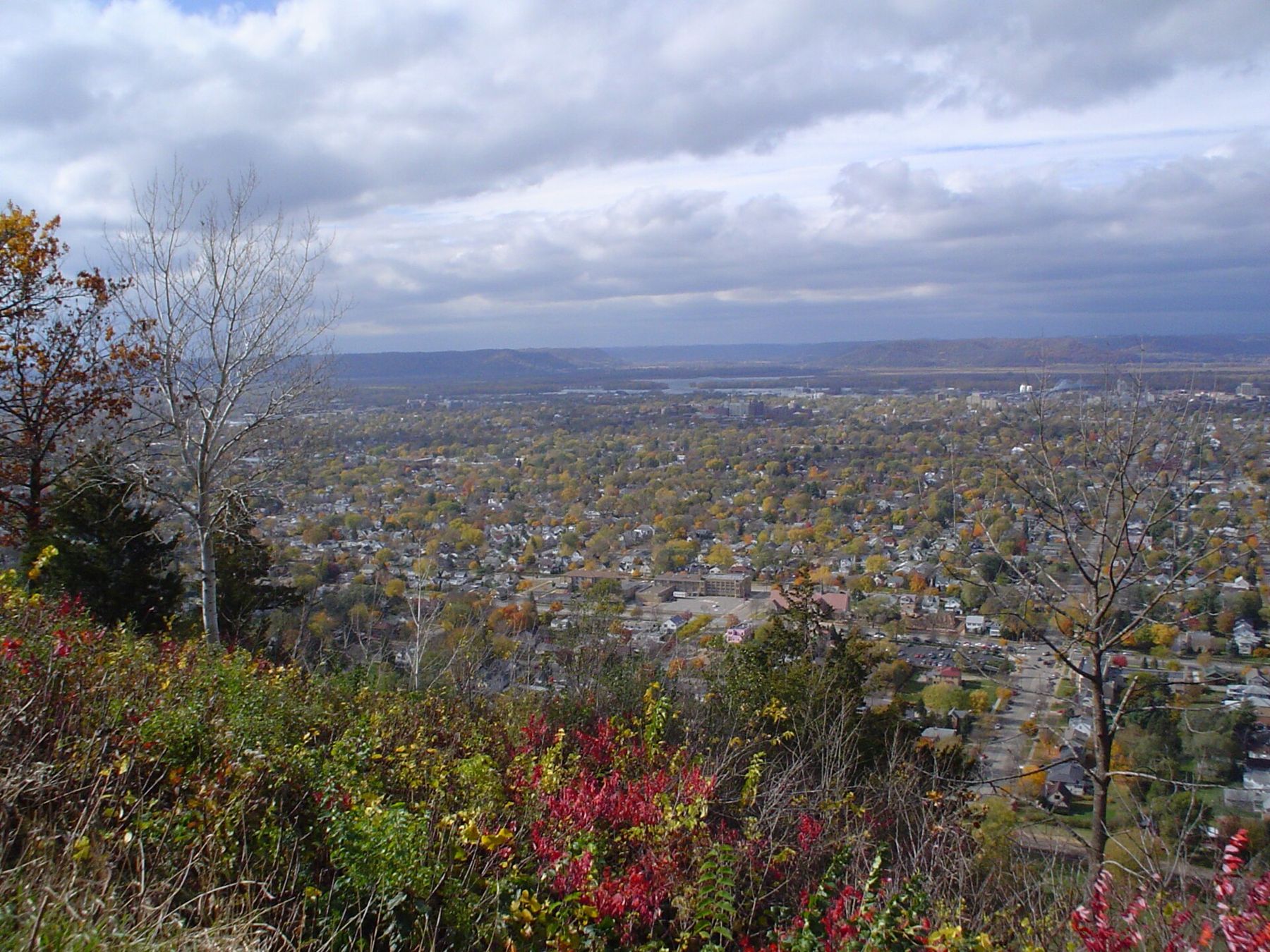
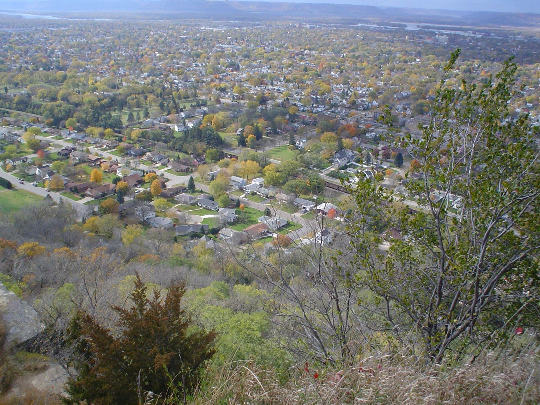
Grandad Bluff is a city park, and a road climbs to its top from the east side of town. At the summit there is a broad overlook with a stone wall at the edge, and from there the view runs out over the whole of La Crosse, the river and the bluffs beyond. On a clear day you can see into Minnesota and Iowa as well as Wisconsin.
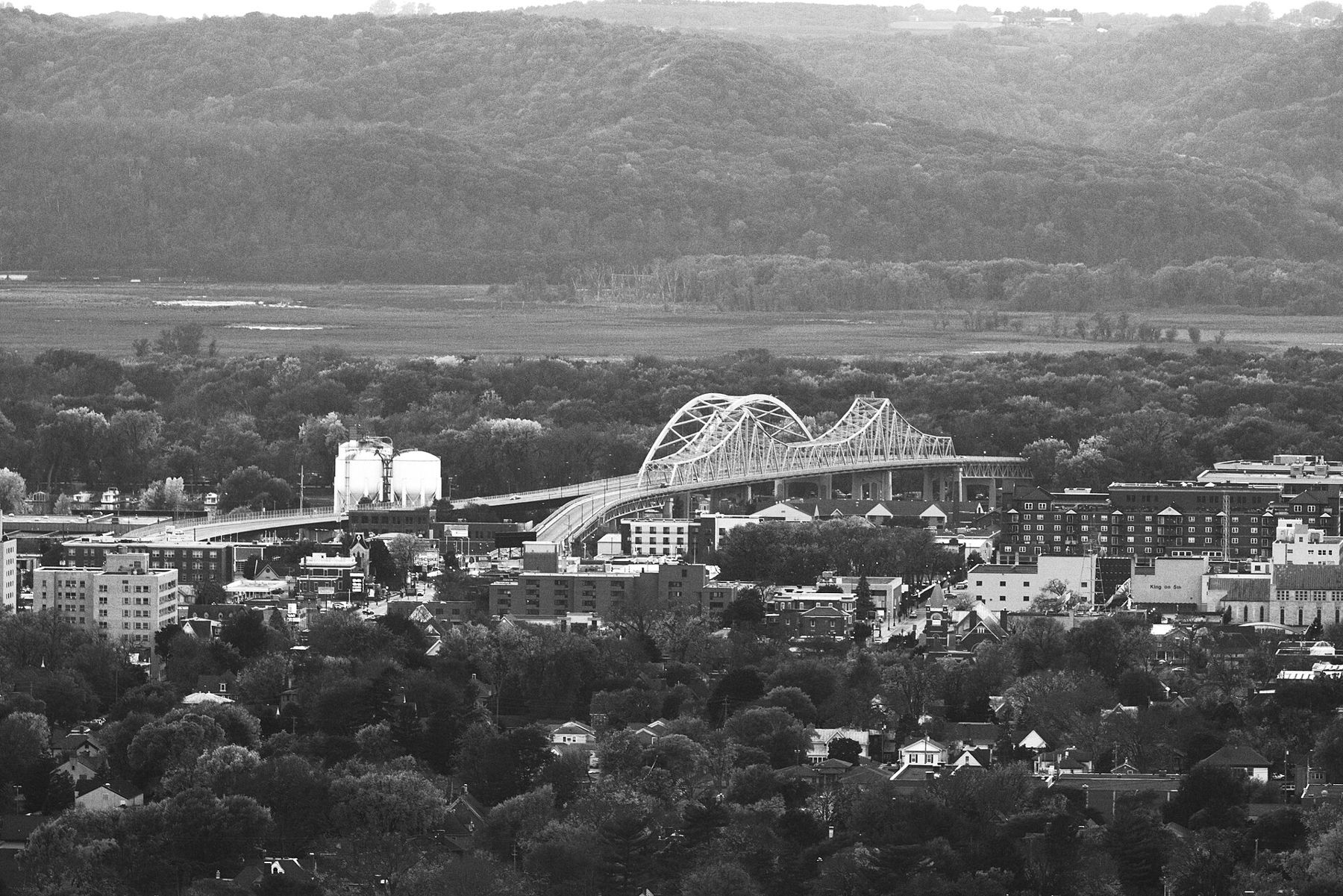
The view rewards a little study. Below you lies the grid of the city, with its church spires and the older brick downtown near the river. Beyond that, the bridges cross the main channel to Barron Island and on to Minnesota. To the north, the river spreads into backwaters and islands; to the south, it narrows between bluffs on its way toward Iowa. The marsh along the La Crosse River cuts a green band through the city below.
Come at sunset if you can, when the light falls across the river and the Minnesota bluffs go gold and then purple. Autumn colour on the bluffs is at its best through October; for the timing, read about bluff colour, week by week. In winter the view is starker but clearer, with the river frozen in places and open in others.
The edges of the bluff are high and sheer. Stay behind the wall and on the paths, and keep children and dogs close. If you want to walk rather than drive up, the trails in the forested land around the bluff climb through woods and coulees, but they are steep in places.
Where three rivers meet
La Crosse takes its name from the game the French saw Ho-Chunk people playing on the prairie here, a stick-and-ball game the French called la crosse. This was Ho-Chunk land, and the river valleys around it had been home to Native peoples for thousands of years. When settlers and traders came, the site's meeting of three rivers made it a natural landing.
The town grew fast in the nineteenth century on lumber. Logs came down the Black River from the pine forests to the north, and sawmills along the waterfront turned them into boards that went down the Mississippi. Steamboats called at the levee, and the railway arrived, and La Crosse became a river and rail centre. Brewing and other industries followed. Much of the brick downtown dates from that boom.
 Further along the riverThe Great River Road down both banks in two days
Today the city is a regional centre with a university, a busy downtown and a river that is now as much for recreation as for trade. Barges still pass, and Lock and Dam No. 7 lies just upstream, but most of the boats you see on a summer day are pleasure boats, fishing boats and the occasional excursion boat.
Barges still pass, and Lock and Dam No. 7 lies just upstream, but most of the boats you see on a summer day are pleasure boats, fishing boats and the occasional excursion boat.
Riverside Park and downtown
Riverside Park runs along the waterfront at the foot of downtown, at the point where the rivers come together. It is the city's front porch: a long green strip with paths along the levee, benches facing the water, an open-air band shell and a dock where river boats tie up. Walk it in the early morning and you will share it with joggers and anglers; on a summer evening it fills with families and music.
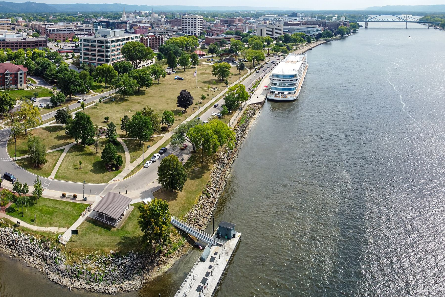
From the park, downtown is only a few blocks away. The older streets have rows of nineteenth-century brick commercial buildings, many now restored, and the area is easy to explore on foot. Look up as you walk; the upper floors and cornices carry most of the old detail. Part of the old commercial core is listed as a historic district, and the blocks closest to the river show how the town once faced the water rather than the road.
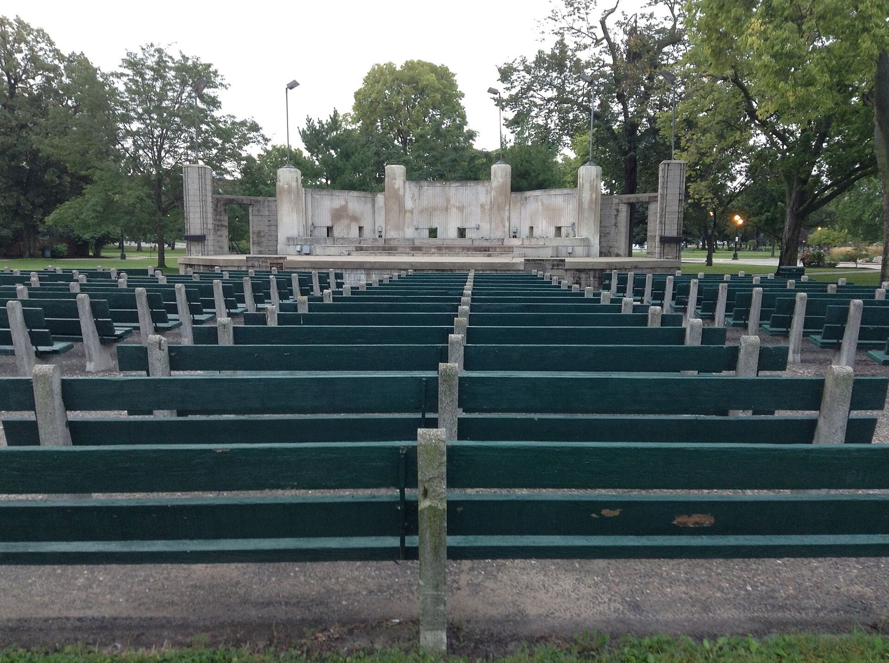
Across the main channel, Pettibone Park on Barron Island has a beach, picnic grounds and a different view back at the city. It is reached by the same bridges that carry traffic on to Minnesota.
Marshes and trails
One of the surprises of La Crosse is how much wild land lies inside it. The La Crosse River Marsh spreads across the middle of the city between downtown and the bluffs, and trails and boardwalks run through it. You can walk or bike from one side of town to the other through cattails and open water, with herons, red-winged blackbirds and muskrats for company.
Beyond the city, the La Crosse River State Trail runs east on an old rail grade through farm country, and the Great River State Trail heads north from Onalaska toward Trempealeau and its national wildlife refuge. Both are crushed-stone trails suited to bikes with wider tyres. Trail passes are required for adult cyclists on Wisconsin state trails; check the current rules before you ride.
The bluffs around the city also hold walking trails, through forest and goat prairie, that link up with the city's parkland. Some are steep and rocky. Wear proper shoes and carry water in summer.
On the river itself, the backwaters north and south of the city are good paddling country, part of the Upper Mississippi River National Wildlife and Fish Refuge that stretches along much of this valley. Stay in the sloughs rather than the main channel, where barge tows and fast boats throw big wakes, and learn the channel markers before you set out. Spring water is cold and often high; wear a life jacket whatever the season.
Crossing to La Crescent
The main way across the river from La Crosse is the pair of bridges carrying US-14/61, which cross the main channel to Barron Island and then on over the backwaters to La Crescent. Further north, the I-90 bridge crosses near French Island to Minnesota at Dresbach.
La Crescent is a short drive over the water, and in spring and autumn it makes an easy pairing with La Crosse. Its scenic drive along the bluff tops passes through orchards that bloom in May and fill with apples in September and October; there is more in the story on orchards and cider on both banks. Spend the morning on Grandad Bluff and the afternoon among the apple trees across the river, and you have seen this stretch of valley from both sides.
Whose pictures these are
- Runner1928CC BY-SA 3.0
- Mathieu LandrettiCC BY-SA 4.0
- Wikideas1CC0
- Wikideas1 Wikideas1 ( Uploads )CC0